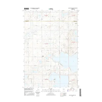
2016 Map of Lake Miltona West
USGS Topo · Published 2016About this map
Leaf Valley serves as the central community in this landscape of glacial lakes and agricultural prairie along the Douglas and Otter Tail county line. The topography is defined by significant water bodies, notably the sprawling southern reach of Lake Miltona and the northern bay of Lake Ida, separated by a narrow neck of land featuring Betsy Ross Point and Christopherson Bay. Smaller basins like Diekow Lake and Vermont Lake are scattered across the township, connected by an artificial drainage network including County Ditch Number Sixty and County Ditch Number Eleven. Local history is anchored by the Saint James Cem near the northern border and Ebenezer Cem further south. The road network, including Co HWY 27 and Co HWY 63, follows the section lines of the Public Land Survey System, illustrating the orderly settlement pattern of this rural Minnesota region.
Find a feature on this map
71 named features on this map. Tap any name to fly to it.
Don’t see what you’re looking for? This feature index may not catch every label — zoom into the map to look around manually.
Map Details
Editions of this 2016 Lake Miltona West Map
This is the sole edition of this map. No revisions or reprints were ever made.
Other maps of this area

1953 · Brainerd
USGS Topo · 1:250,000

1953 · Saint Cloud
USGS Topo · 1:250,000

1957 · Brainerd
USGS Topo · 1:250,000

1957 · Saint Cloud
USGS Topo · 1:250,000

1958 · Saint Cloud
USGS Topo · 1:250,000

1958 · Brainerd
USGS Topo · 1:250,000

1965 · Brainerd
USGS Topo · 1:250,000

1966 · Brandon
USGS Topo · 1:24,000

1966 · Alexandria West
USGS Topo · 1:24,000

1966 · Alexandria East
USGS Topo · 1:24,000
Featured Places
- Leaf Valley, MN
- Effington Township, MN
- Parkers Prairie Township, MN
- Otter Tail County, MN
- Douglas County, MN