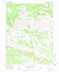
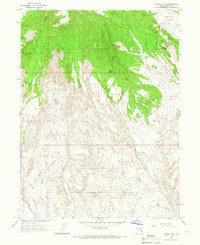
1965 Map of Lake Mountain
USGS Topo · Published 1984About this map
Ashley National Forest and the Uintah and Ouray Indian Reservation meet across this mountainous terrain, marked by the prominent Old Indian Treaty Boundary. The landscape is defined by the high elevations of Mosby Mtn and Middle Mountain, where an intricate network of named springs like Uranium Spring and Prospector Spring sustained early exploration and land use. The presence of the Little Water Mines and several Gravel Pits suggests the area's mid-century extractive activity, while the Chalk Cliffs and Sawtooth Ridge provide distinct geological context for the eastern Uinta basin. A complex system of livestock-era infrastructure is visible through numerous named parks such as Mosby Park and Bills Park, alongside managed water sources like Burton Reservoir and Gull Lake.
Find a feature on this map
74 named features on this map. Tap any name to fly to it.
Don’t see what you’re looking for? This feature index may not catch every label — zoom into the map to look around manually.
Map Details
Editions of this 1965 Lake Mountain Map
3 editions found
Other maps of this area

1885 · Ashley
USGS Topo · 1:250,000

1906 · Marsh Peak
USGS Topo · 1:125,000

1908 · Marsh Peak
USGS Topo · 1:125,000

1917 · Vernal
USGS Topo · 1:125,000

1954 · Vernal
USGS Topo · 1:250,000

1958 · Vernal
USGS Topo · 1:250,000

1960 · Vernal
USGS Topo · 1:250,000

1964 · Lapoint
USGS Topo · 1:24,000
1964 · Whiterocks
USGS Topo · 1:24,000
1964 · Vernal NW
USGS Topo · 1:24,000