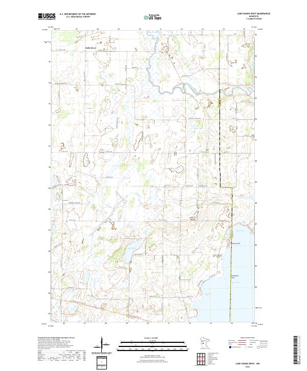
2022 Map of Lake Osakis West
USGS Topo · Published 2022About this map
Lake Osakis dominates the southeastern corner of this Douglas County landscape, where the shoreline is defined by Miller Bay and Peterson Bay. The terrain transitions from the marshy lowlands surrounding Bird Lake and Stowe Lake to the agricultural reaches of the north. The Long Prairie River and its various tributaries, including Calamus Cr and the Crooked Lake Ditch, create a complex network of wetlands and drainage throughout the townships. The Central Lakes State Trl cuts across the southern portion of the map, following a former rail corridor that historically linked these lakeside communities. This modern survey captures the enduring rural character of the area, illustrating how local roads like Bird Lake Rd NE and Calvary Rd NE still follow the section lines of the original land survey system.
Find a feature on this map
52 named features on this map. Tap any name to fly to it.
Don’t see what you’re looking for? This feature index may not catch every label — zoom into the map to look around manually.
Map Details
Editions of this 2022 Lake Osakis West Map
This is the sole edition of this map. No revisions or reprints were ever made.
Other maps of this area

1953 · Brainerd
USGS Topo · 1:250,000

1953 · Saint Cloud
USGS Topo · 1:250,000

1957 · Brainerd
USGS Topo · 1:250,000

1957 · Saint Cloud
USGS Topo · 1:250,000

1958 · Saint Cloud
USGS Topo · 1:250,000

1958 · Brainerd
USGS Topo · 1:250,000

1965 · Brainerd
USGS Topo · 1:250,000

1966 · West Union
USGS Topo · 1:24,000

1966 · Osakis
USGS Topo · 1:24,000

1966 · Lake Osakis East
USGS Topo · 1:24,000