
1966 Map of Lake Osakis West
USGS Topo · Published 1968About this map
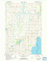
Lake Osakis dominates the southern landscape of this 1960s survey, showing its intricate shoreline and prominent features like Peterson Bay and Miller Bay. The map captures a transition in land use, where the conservation efforts of the Belle River State Wildlife Management Area meet the working landscape of the Great Northern railway corridor.
Find a feature on this map
21 named features on this map. Tap any name to fly to it.
Don’t see what you’re looking for? This feature index may not catch every label — zoom into the map to look around manually.
Map Details
Editions of this 1966 Lake Osakis West Map
2 editions found
Other maps of this area

1953 · Brainerd
USGS Topo · 1:250,000

1953 · Saint Cloud
USGS Topo · 1:250,000

1957 · Brainerd
USGS Topo · 1:250,000

1957 · Saint Cloud
USGS Topo · 1:250,000

1958 · Saint Cloud
USGS Topo · 1:250,000

1958 · Brainerd
USGS Topo · 1:250,000

1965 · Brainerd
USGS Topo · 1:250,000

1966 · West Union
USGS Topo · 1:24,000

1966 · Osakis
USGS Topo · 1:24,000

1966 · Lake Osakis East
USGS Topo · 1:24,000