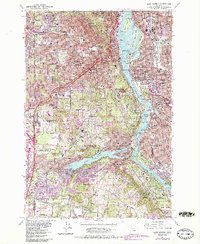
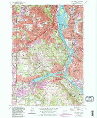
1961 Map of Lake Oswego
USGS Topo · Published 1985About this map
Oswego Lake and the winding Willamette River serve as the geographic center of this mid-century portrait of suburban expansion south of Portland. The map highlights the established institutional footprint of the region, anchored by Reed College, Lewis and Clark College, and Marylhurst College. Along the riverbanks, the presence of the Portland Traction Co railroad and the Sellwood Bridge illustrate the critical transit corridors connecting Sellwood and West Linn to the urban core. Industrial and recreational land uses coexist, shown by the proximity of Gravel Pits and the Oswego Lake Country Club. A high concentration of civic infrastructure is visible, including the Riverview Cemetery, Ahavai Sholom Cem, and numerous neighborhood schools like Bridlemile Sch and Maplewood Sch, reflecting the postwar development of communities such as Raleigh Hills and Lake Oswego.
Find a feature on this map
174 named features on this map. Tap any name to fly to it.
Don’t see what you’re looking for? This feature index may not catch every label — zoom into the map to look around manually.
Map Details
Editions of this 1961 Lake Oswego Map
5 editions found
Other maps of this area

1897 · Portland
USGS Topo · 1:62,500

1905 · Portland
USGS Topo · 1:62,500

1914 · Oregon City
USGS Topo · 1:62,500

1915 · Hillsboro
USGS Topo · 1:62,500

1916 · Tualatin
USGS Topo · 1:62,500

1918 · Hillsboro
USGS Topo · 1:62,500

1939 · Oregon City
USGS Topo · 1:62,500

1939 · Tualatin
USGS Topo · 1:62,500

1940 · Tualatin
USGS Topo · 1:62,500

1940 · Hillsboro
USGS Topo · 1:62,500