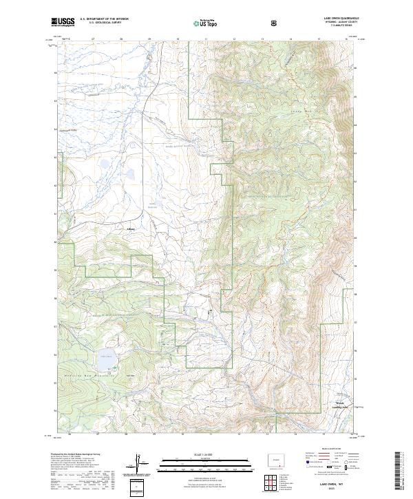
2023 Map of Lake Owen
USGS Topo · Published 2023About this map
Albany and the surrounding high country of the Medicine Bow Mountains define this landscape on the eastern edge of the Medicine Bow National Forest. The map captures a high-elevation environment where water management and ranching infrastructure meet the wilderness, evidenced by Sunby Reservoir and Sundby Reservoir Number 2. In the northern reaches, the Middle Fork Little Laramie River flows through the Centennial Valley, while the southern area is dominated by the prominence of Sheep Mtn and Iron Mtn. Local travel is dictated by routes such as Fox Creek Rd and Hecht Creek Rd, which connect isolated settlements like Woods Landing-Jelm to the surrounding drainage basins of Lake Owen Creek and the Laramie River. These forest and valley tracks provide a clear picture of the land use patterns and access points for the region.
Find a feature on this map
39 named features on this map. Tap any name to fly to it.
Don’t see what you’re looking for? This feature index may not catch every label — zoom into the map to look around manually.
Map Details
Editions of this 2023 Lake Owen Map
This is the sole edition of this map. No revisions or reprints were ever made.
Other maps of this area

1895 · Laramie
USGS Topo · 1:125,000

1902 · Laramie
USGS Topo · 1:125,000

1905 · Laramie
USGS Topo · 1:125,000

1906 · Medicine Bow
USGS Topo · 1:125,000

1906 · Laramie
USGS Topo · 1:125,000

1908 · Laramie
USGS Topo · 1:125,000

1908 · Medicine Bow
USGS Topo · 1:125,000

1954 · Cheyenne
USGS Topo · 1:250,000

1954 · Rawlins
USGS Topo · 1:250,000

1958 · Rawlins
USGS Topo · 1:250,000