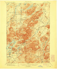
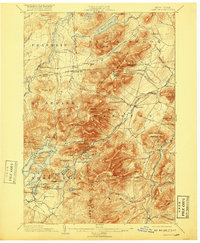
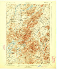
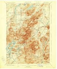
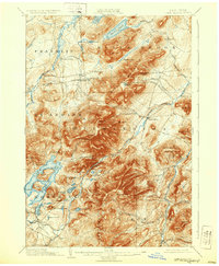
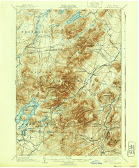
1898 Map of Lake Placid
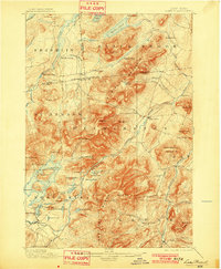
USGS Topo · Published 1908About this map
John Browns Grave stands as a quiet landmark south of the emerging resort community at Lake Placid during this late 19th-century survey. The landscape is defined by the massive silhouettes of the Sentinel Range and Mt. Whiteface, while the industrial history of the Adirondacks is visible in the cluster of charcoal or lime production sites at West Kilns, Middle Kilns, and East Kilns in the north. Settlement is concentrated along the Ausable River and around Newman, reflecting a period before modern commercial expansion reshaped the village. The map detail highlights the intricate shoreline of the lake itself, featuring Moose Id. and Buck Id., as well as numerous isolated ponds and notches that provided the only passage through these high peaks for early travelers and loggers.
Find a feature on this map
81 named features on this map. Tap any name to fly to it.
Don’t see what you’re looking for? This feature index may not catch every label — zoom into the map to look around manually.
Map Details
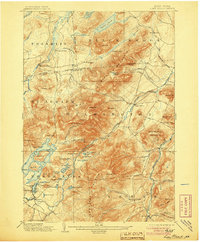
Editions of this 1898 Lake Placid Map
12 editions found

1898 edition
15.4 x 20.1 inches
1901 edition
16.6 x 20.2 inches
1905 edition
16.6 x 20.1 inches
1908 edition
16.6 x 20.2 inches
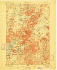
1911 edition
16.6 x 20.2 inches
1917 edition
16.6 x 20.2 inches
1924 edition
16.6 x 20.1 inches
1929 edition
16.6 x 20.1 inches
1932 edition
16.6 x 20.2 inches
1939 edition
16.6 x 20.1 inches
1946 edition
17 x 20.8 inches
1950 edition
17 x 20.9 inches
Other maps of this area

1894 · Elizabethtown
USGS Topo · 1:62,500

1895 · Elizabethtown
USGS Topo · 1:62,500

1895 · Mt. Marcy
USGS Topo · 1:62,500

1895 · Ausable
USGS Topo · 1:62,500

1896 · Lake Placid
USGS Topo · 1:62,500
1898 · Lake Placid
USGS Topo · 1:62,500

1901 · Elizabethtown
USGS Topo · 1:62,500

1902 · Mt. Marcy
USGS Topo · 1:62,500

1902 · Saranac
USGS Topo · 1:62,500

1903 · Ausable
USGS Topo · 1:62,500