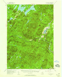
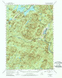
1954 Map of Lake Pleasant
USGS Topo · Published 1959About this map
Lake Pleasant and Speculator serve as the primary hubs of activity in this 1950s study of the southern Adirondacks. The landscape is defined by the winding course of the Sacandaga River and its numerous tributaries, including Shanty Brook and Elbow Creek. The map documents the layout of established lakeside communities and recreation sites like Camp of the Woods and the Sacandaga Public Campsite at Moffitt Beach.
Find a feature on this map
121 named features on this map. Tap any name to fly to it.
Don’t see what you’re looking for? This feature index may not catch every label — zoom into the map to look around manually.
Map Details
Editions of this 1954 Lake Pleasant Map
6 editions found

Other maps of this area

1898 · Thirteenth Lake
USGS Topo · 1:62,500

1899 · Indian Lake
USGS Topo · 1:62,500

1899 · Broadalbin
USGS Topo · 1:62,500

1900 · Canada Lake
USGS Topo · 1:62,500

1901 · Lassellsville
USGS Topo · 1:62,500

1902 · Broadalbin
USGS Topo · 1:62,500

1902 · Indian Lake
USGS Topo · 1:62,500

1903 · West Canada Lakes
USGS Topo · 1:62,500

1903 · Gloversville
USGS Topo · 1:62,500

1903 · Lassellsville
USGS Topo · 1:62,500