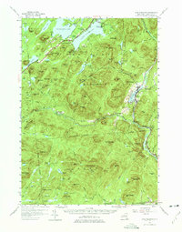
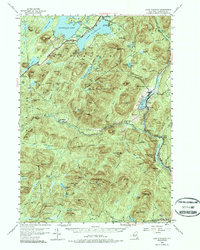
1954 Map of Lake Pleasant
USGS Topo · Published 1975About this map
Speculator and the town of Lake Pleasant anchor this mid-century look at central Hamilton County, situated entirely within the Adirondack State Park. The landscape is defined by the convergence of major water bodies like Sacandaga Lake and the northern reaches of the West Branch Sacandaga River. Settlement patterns reflect the era's focus on seasonal tourism and small-town residency, with established clusters at Wells and Gilmantown contrasted by recreational sites like Camp of the Woods and Sacandaga Camp. Local life is further evidenced by landmarks such as St Ann Ch, the Piseco Sch, and the South Side Lake Cem. Topographical detail reveals the complex network of "vlys" and brooks, including Shanty Brook and Groff Creek, which drain the numerous peaks such as Hamilton Mtn and Mt Dunham.
Find a feature on this map
130 named features on this map. Tap any name to fly to it.
Don’t see what you’re looking for? This feature index may not catch every label — zoom into the map to look around manually.
Map Details
Editions of this 1954 Lake Pleasant Map
6 editions found

Other maps of this area

1898 · Thirteenth Lake
USGS Topo · 1:62,500

1899 · Indian Lake
USGS Topo · 1:62,500

1899 · Broadalbin
USGS Topo · 1:62,500

1900 · Canada Lake
USGS Topo · 1:62,500

1901 · Lassellsville
USGS Topo · 1:62,500

1902 · Broadalbin
USGS Topo · 1:62,500

1902 · Indian Lake
USGS Topo · 1:62,500

1903 · West Canada Lakes
USGS Topo · 1:62,500

1903 · Gloversville
USGS Topo · 1:62,500

1903 · Lassellsville
USGS Topo · 1:62,500