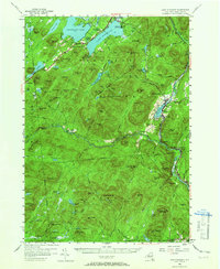
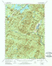
1954 Map of Lake Pleasant
USGS Topo · Published 1965About this map
Speculator and the village of Lake Pleasant serve as the primary hubs in this mid-century survey of the Adirondacks, situated at the junction of Sacandaga Lake and its namesake neighbor. The landscape is defined by the high peaks of the Silver Lake Wilderness and the winding course of the West Branch Sacandaga River. Recreational sites such as Camp of the Woods, Sacandaga Camp, and the Sacandaga Public Campsite at Moffitt Beach reflect the region's enduring appeal for summer residents and sportsmen.
Find a feature on this map
115 named features on this map. Tap any name to fly to it.
Don’t see what you’re looking for? This feature index may not catch every label — zoom into the map to look around manually.
Map Details
Editions of this 1954 Lake Pleasant Map
6 editions found

Other maps of this area

1898 · Thirteenth Lake
USGS Topo · 1:62,500

1899 · Indian Lake
USGS Topo · 1:62,500

1899 · Broadalbin
USGS Topo · 1:62,500

1900 · Canada Lake
USGS Topo · 1:62,500

1901 · Lassellsville
USGS Topo · 1:62,500

1902 · Broadalbin
USGS Topo · 1:62,500

1902 · Indian Lake
USGS Topo · 1:62,500

1903 · West Canada Lakes
USGS Topo · 1:62,500

1903 · Gloversville
USGS Topo · 1:62,500

1903 · Lassellsville
USGS Topo · 1:62,500