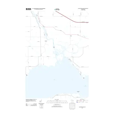
2013 Map of Lake Poygan
USGS Topo · Published 2013About this map
The Wolf River meanders southward through this portion of Winnebago County, feeding into the expansive waters of Lake Poygan and Lake Winneconne. This riparian landscape is defined by its complex hydrology, where Pages Slough and the Rat River converge near the small settlement of Zittau. The area around Orihula serves as a focal point for river traffic and lakeside life, characterized by a network of local roads such as Arrowhead Rd and Riverview Dr that trace the water's edge.
Find a feature on this map
49 named features on this map. Tap any name to fly to it.
Don’t see what you’re looking for? This feature index may not catch every label — zoom into the map to look around manually.
Map Details
Editions of this 2013 Lake Poygan Map
This is the sole edition of this map. No revisions or reprints were ever made.
Other maps of this area

1955 · Green Bay
USGS Topo · 1:250,000

1956 · New London
USGS Topo · 1:48,000

1956 · Weyauwega
USGS Topo · 1:48,000

1961 · Poy Sippi
USGS Topo · 1:62,500

1961 · Oshkosh
USGS Topo · 1:62,500

1961 · Lake Poygan
USGS Topo · 1:24,000
1961 · Auroraville
USGS Topo · 1:24,000

1961 · Oshkosh NW
USGS Topo · 1:24,000
1961 · Eureka
USGS Topo · 1:24,000
1961 · Omro
USGS Topo · 1:24,000