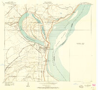
1909 Map of Lake Providence
USGS Topo · Published 1958About this map
The oxbow of Lake Providence and the shifting course of the Mississippi River dominate this early twentieth-century landscape in East Carroll Parish. The area is defined by a dense concentration of named agricultural estates, including Belle Mead Plantation, Tyrone Plantation, and Longwood Plantation, which illustrate the post-Reconstruction land patterns along the fertile alluvial plain. The town of Lake Providence sits protected behind the levee system, while the surrounding countryside is dotted with community centers like Wintersfield School and numerous local congregations such as Evergreen Church and Cane Ridge Church.
Find a feature on this map
42 named features on this map. Tap any name to fly to it.
Don’t see what you’re looking for? This feature index may not catch every label — zoom into the map to look around manually.
Map Details
Editions of this 1909 Lake Providence Map
2 editions found
Other maps of this area

1909 · Baxter Bayou
USGS Topo · 1:24,000

1909 · Lake Providence
USGS Topo · 1:24,000

1909 · Wilsons Point
USGS Topo · 1:24,000

1909 · Millikin
USGS Topo · 1:24,000

1909 · Ashton Bridge
USGS Topo · 1:24,000

1911 · Lake Providence
USGS Topo · 1:31,680

1911 · Baxter Bayou
USGS Topo · 1:24,000

1912 · Ashton Bridge
USGS Topo · 1:31,680

1913 · Wilson Point
USGS Topo · 1:31,680

1914 · Baxter Bayou
USGS Topo · 1:31,680