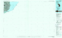
1985 Map of Lake St. Clair South
USGS Topo · Published 1985About this map
The industrialized shoreline of Lake St Clair and the Detroit River dominates this planimetric study, capturing the dense residential and commercial expansion of southeast Michigan in the mid-1980s. The map delineates the intricate boundaries of the Grosse Pointe communities, including Grosse Pointe Park, Grosse Pointe Farms, and Grosse Pointe Shores, as they line the waterfront. To the north, the urban grid extends through Roseville and St Clair Shores into Macomb Co.
Find a feature on this map
19 named features on this map. Tap any name to fly to it.
Don’t see what you’re looking for? This feature index may not catch every label — zoom into the map to look around manually.
Map Details
Editions of this 1985 Lake St. Clair South Map
2 editions found
Other maps of this area

1905 · Detroit
USGS Topo · 1:62,500

1905 · Grosse Pointe
USGS Topo · 1:62,500

1906 · Wyandotte
USGS Topo · 1:62,500

1908 · Rochester
USGS Topo · 1:62,500

1912 · Mt Clemens
USGS Topo · 1:62,500

1912 · Wyandotte
USGS Topo · 1:62,500

1914 · Algonac
USGS Topo · 1:62,500

1918 · Detroit
USGS Topo · 1:62,500

1918 · Grosse Pointe
USGS Topo · 1:62,500

1924 · Detroit
USGS Topo · 1:62,500