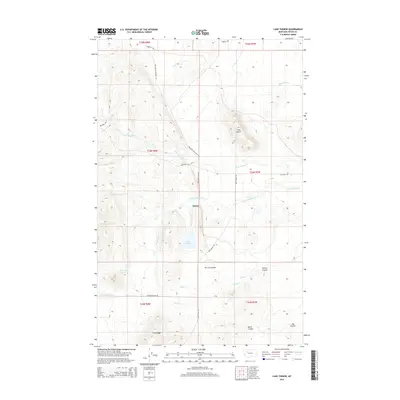
2014 Map of Lake Theboe
USGS Topo · Published 2014About this map
Saypo stands as a focal point in this portion of Teton County, where the plains meet the rising foothills of the Rocky Mountain Front. The landscape is defined by an intricate network of waterways, including the N Fork Willow Cr and S Fork Willow Cr, which converge near the historic settlement area. Notable landmarks like Pine Butte and Long Ridge provide significant topographic relief, while Lake Theboe and the John Lane Reservoir suggest the importance of water management for local ranching and agriculture. The presence of routes such as Salmond Ranch Rd and Bellview Rd illustrates the rural infrastructure connecting disparate homesteads and grazing lands. Further south, features like Tin Can Coulee and Kade Cr drain the undulating terrain, highlighting a geography shaped by seasonal runoff and long-standing land use patterns in this big sky environment.
Find a feature on this map
29 named features on this map. Tap any name to fly to it.
Don’t see what you’re looking for? This feature index may not catch every label — zoom into the map to look around manually.
Map Details
Editions of this 2014 Lake Theboe Map
This is the sole edition of this map. No revisions or reprints were ever made.
Other maps of this area

1903 · Saypo
USGS Topo · 1:125,000

1920 · Choteau
USGS Topo · 1:125,000

1955 · Choteau
USGS Topo · 1:250,000

1957 · Choteau
USGS Topo · 1:250,000

1958 · Choteau
USGS Topo · 1:250,000

1958 · Ear Mountain
USGS Topo · 1:24,000

1958 · Lake Theboe
USGS Topo · 1:24,000

1958 · Cave Mountain
USGS Topo · 1:24,000
1958 · Twin Lakes
USGS Topo · 1:24,000

1958 · Castle Reef
USGS Topo · 1:24,000