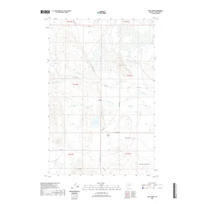
2020 Map of Lake Theboe
USGS Topo · Published 2020About this map
Saypo sits at the heart of this Montana landscape, where the prairie begins its transition into the high ground of the Rocky Mountain Front. The area is defined by a complex drainage network feeding into Lake Theboe, with the South Fork Willow Creek and Jefferson Creek converging near the settlement. The map reveals a ranching and agricultural orientation, marked by roads like Bellview Road and Deep Creek Road that follow the natural contours of the land. High points such as Pine Butte and the elevation of Long Ridge provide a vertical contrast to the basin occupied by John Lane Reservoir. The intricate labeling of local coulees, including Tin Can Coulee and Fowler Coulee, reflects the importance of small-scale hydrology and topographic landmarks to the local geography and land management in Teton County.
Find a feature on this map
30 named features on this map. Tap any name to fly to it.
Don’t see what you’re looking for? This feature index may not catch every label — zoom into the map to look around manually.
Map Details
Editions of this 2020 Lake Theboe Map
This is the sole edition of this map. No revisions or reprints were ever made.
Other maps of this area

1903 · Saypo
USGS Topo · 1:125,000

1920 · Choteau
USGS Topo · 1:125,000

1955 · Choteau
USGS Topo · 1:250,000

1957 · Choteau
USGS Topo · 1:250,000

1958 · Choteau
USGS Topo · 1:250,000

1958 · Ear Mountain
USGS Topo · 1:24,000

1958 · Lake Theboe
USGS Topo · 1:24,000

1958 · Cave Mountain
USGS Topo · 1:24,000
1958 · Twin Lakes
USGS Topo · 1:24,000

1958 · Castle Reef
USGS Topo · 1:24,000