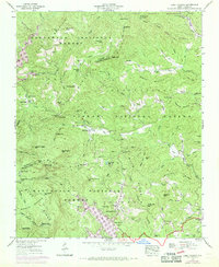
1946 Map of Lake Toxaway
USGS Topo · Published 1970About this map
Lake Toxaway and the surrounding high country of the Blue Ridge are documented here just as modern infrastructure began to weave through these remote gaps and valleys. The map shows the convergence of the Nantahala National Forest and Pisgah National Forest, a landscape defined by sharp elevation changes from Hogback Mountain to Big Pisgah Mtn. Local life is anchored by country churches like Oak Grove Ch and Macedonia Ch, while the inclusion of the NASA Tracking Station on Glassmine Mountain marks the intersection of traditional Appalachian terrain with the technological expansion of the mid-20th century.
Find a feature on this map
106 named features on this map. Tap any name to fly to it.
Don’t see what you’re looking for? This feature index may not catch every label — zoom into the map to look around manually.
Map Details
Editions of this 1946 Lake Toxaway Map
4 editions found
Other maps of this area

1891 · Cowee
USGS Topo · 1:125,000

1897 · Cowee
USGS Topo · 1:125,000

1905 · Pisgah
USGS Topo · 1:125,000

1906 · Pisgah
USGS Topo · 1:125,000

1907 · Cowee
USGS Topo · 1:125,000

1935 · Eastatoe Gap
USGS Topo · 1:24,000

1935 · Sam Knob
USGS Topo · 1:24,000

1935 · Cashiers
USGS Topo · 1:24,000

1935 · Rosman
USGS Topo · 1:24,000

1935 · Tuckaseigee
USGS Topo · 1:24,000