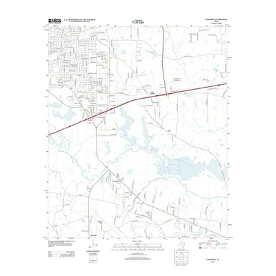
2013 Map of Lakeport
USGS Topo · Published 2013About this map
The Sabine River winds through this East Texas landscape, defining the geographic character of the region south of Longview. The riparian corridor is punctuated by numerous tributaries and man-made water bodies, including Ferguson Cr Reservoir and the northern reaches of Lake Cherokee. This era shows a mix of educational and transportation infrastructure, anchored by the campus of Letourneau Univ and the expansive runways of the East Texas Regional Airport.
Find a feature on this map
205 named features on this map. Tap any name to fly to it.
Don’t see what you’re looking for? This feature index may not catch every label — zoom into the map to look around manually.
Map Details
Editions of this 2013 Lakeport Map
This is the sole edition of this map. No revisions or reprints were ever made.
Other maps of this area

1936 · Kilgore
USGS Topo · 1:48,000

1940 · Kilgore
USGS Topo · 1:62,500

1956 · Tyler
USGS Topo · 1:250,000

1958 · Tatum
USGS Topo · 1:62,500

1960 · White Oak
USGS Topo · 1:24,000

1961 · Hallsville
USGS Topo · 1:24,000

1962 · Longview Heights
USGS Topo · 1:24,000

1971 · Kilgore NE
USGS Topo · 1:24,000
1971 · Kilgore SE
USGS Topo · 1:24,000

1983 · Tatum
USGS Topo · 1:24,000