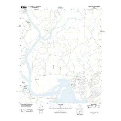
2010 Map of Lakeside Village
USGS Topo · Published 2010About this map
Lake Whitney dominates the southern landscape where the Brazos River and Nolan River converge, creating a complex geography of sloughs, bends, and hollows. The area around White Bluff and Lakeside Village reflects a transition from traditional rural ranching lands to contemporary lakeside development, evidenced by the intricate street networks like Sandy Oaks Dr and Greenbriar Dr near the water's edge.
Find a feature on this map
50 named features on this map. Tap any name to fly to it.
Don’t see what you’re looking for? This feature index may not catch every label — zoom into the map to look around manually.
Map Details
Editions of this 2010 Lakeside Village Map
This is the sole edition of this map. No revisions or reprints were ever made.
Other maps of this area

1888 · Meridian
USGS Topo · 1:125,000

1889 · Granbury
USGS Topo · 1:125,000

1891 · Cleburne
USGS Topo · 1:125,000

1892 · Waco
USGS Topo · 1:125,000

1894 · Meridian
USGS Topo · 1:125,000

1894 · Cleburne
USGS Topo · 1:125,000

1920 · Waco
USGS Topo · 1:125,000

1924 · Cleburne 3-B
USGS Topo · 1:48,000

1924 · Waco 2-b
USGS Topo · 1:48,000

1924 · Cleburne 3-C
USGS Topo · 1:48,000