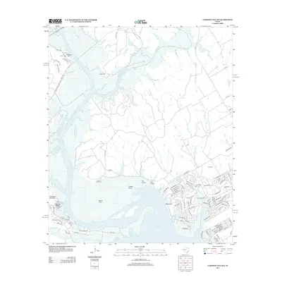
2012 Map of Lakeside Village
USGS Topo · Published 2012About this map
Lake Whitney and the Brazos River dominate the geography of this central Texas landscape, where the water has carved deep into the limestone. The topography is defined by significant elevations such as the Powelldale Mountains and Robinson Bluff, alongside a series of drainage features like Phelps Cr and Benson Slough. To the east, the White Bluff development shows a dense network of modern residential planning, contrasting with the more dispersed rural character found near Indian Lodge. Genealogists will find interest in several local burial sites, including Dodson Cem, Heath Cem, and the Steiner Valley Cem, which remain as markers of the area's long-term settlement. The map also records the winding course of the Nolan River as it joins the larger reservoir system.
Find a feature on this map
120 named features on this map. Tap any name to fly to it.
Don’t see what you’re looking for? This feature index may not catch every label — zoom into the map to look around manually.
Map Details
Editions of this 2012 Lakeside Village Map
This is the sole edition of this map. No revisions or reprints were ever made.
Other maps of this area

1888 · Meridian
USGS Topo · 1:125,000

1889 · Granbury
USGS Topo · 1:125,000

1891 · Cleburne
USGS Topo · 1:125,000

1892 · Waco
USGS Topo · 1:125,000

1894 · Meridian
USGS Topo · 1:125,000

1894 · Cleburne
USGS Topo · 1:125,000

1920 · Waco
USGS Topo · 1:125,000

1924 · Cleburne 3-B
USGS Topo · 1:48,000

1924 · Waco 2-b
USGS Topo · 1:48,000

1924 · Cleburne 3-C
USGS Topo · 1:48,000