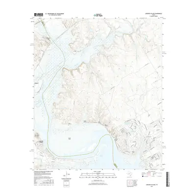
2016 Map of Lakeside Village
USGS Topo · Published 2016About this map
Lake Whitney dominates the southern landscape where the Brazos River meets the confluence of the Nolan River and Steele Cr. Along the western banks, the community of Lakeside Village is situated near the Powelldale Mountains, while the settlement of Kopperl lies further north along the river valley. The topography is marked by significant elevation changes, notably at Robinson Bluff and White Bluff, which overlook the expansive waters and fertile basins.
Find a feature on this map
97 named features on this map. Tap any name to fly to it.
Don’t see what you’re looking for? This feature index may not catch every label — zoom into the map to look around manually.
Map Details
Editions of this 2016 Lakeside Village Map
This is the sole edition of this map. No revisions or reprints were ever made.
Other maps of this area

1888 · Meridian
USGS Topo · 1:125,000

1889 · Granbury
USGS Topo · 1:125,000

1891 · Cleburne
USGS Topo · 1:125,000

1892 · Waco
USGS Topo · 1:125,000

1894 · Meridian
USGS Topo · 1:125,000

1894 · Cleburne
USGS Topo · 1:125,000

1920 · Waco
USGS Topo · 1:125,000

1924 · Cleburne 3-B
USGS Topo · 1:48,000

1924 · Waco 2-b
USGS Topo · 1:48,000

1924 · Cleburne 3-C
USGS Topo · 1:48,000