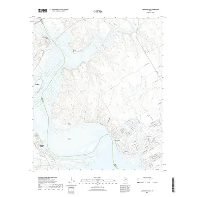
2019 Map of Lakeside Village
USGS Topo · Published 2019About this map
The confluence of the Brazos River and Nolan River defines this landscape on the border of Bosque and Hill counties. Much of the lower terrain is submerged or shaped by Lake Whitney, creating a complex shoreline that surrounds Steiner Valley and the residential developments at White Bluff. The geography is characterized by significant vertical relief, from the heights of the Powelldale Mountains and Robinson Bluff to several deeply cut drainages including Hulett Hollow and Hay Hollow. Local history is anchored by several small burial grounds scattered across the upland ridges, such as Dodson Cem and Heath Cem. The area around Lakeside Village shows a transition from traditional ranching lands to a more recreation-focused economy, with numerous small roads and private drives providing access to the riverfront and lakeside properties.
Find a feature on this map
96 named features on this map. Tap any name to fly to it.
Don’t see what you’re looking for? This feature index may not catch every label — zoom into the map to look around manually.
Map Details
Editions of this 2019 Lakeside Village Map
This is the sole edition of this map. No revisions or reprints were ever made.
Other maps of this area

1888 · Meridian
USGS Topo · 1:125,000

1889 · Granbury
USGS Topo · 1:125,000

1891 · Cleburne
USGS Topo · 1:125,000

1892 · Waco
USGS Topo · 1:125,000

1894 · Meridian
USGS Topo · 1:125,000

1894 · Cleburne
USGS Topo · 1:125,000

1920 · Waco
USGS Topo · 1:125,000

1924 · Cleburne 3-B
USGS Topo · 1:48,000

1924 · Waco 2-b
USGS Topo · 1:48,000

1924 · Cleburne 3-C
USGS Topo · 1:48,000