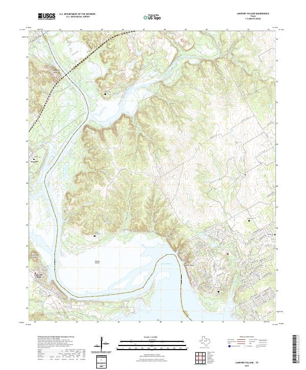
2022 Map of Lakeside Village
USGS Topo · Published 2022About this map
The Brazos River carves a deep path through Central Texas here, feeding into the expansive Lake Whitney and defining the boundary between Hill and Bosque counties. This modern survey illustrates the evolved residential landscape surrounding the reservoir, particularly at Lakeside Village and the resort community of White Bluff. The terrain is marked by numerous draws and hollows such as Hulett Hollow and Haw Hollow that drain toward the main river channel.
Find a feature on this map
95 named features on this map. Tap any name to fly to it.
Don’t see what you’re looking for? This feature index may not catch every label — zoom into the map to look around manually.
Map Details
Editions of this 2022 Lakeside Village Map
This is the sole edition of this map. No revisions or reprints were ever made.
Other maps of this area

1888 · Meridian
USGS Topo · 1:125,000

1889 · Granbury
USGS Topo · 1:125,000

1891 · Cleburne
USGS Topo · 1:125,000

1892 · Waco
USGS Topo · 1:125,000

1894 · Meridian
USGS Topo · 1:125,000

1894 · Cleburne
USGS Topo · 1:125,000

1920 · Waco
USGS Topo · 1:125,000

1924 · Cleburne 3-B
USGS Topo · 1:48,000

1924 · Waco 2-b
USGS Topo · 1:48,000

1924 · Cleburne 3-C
USGS Topo · 1:48,000