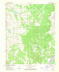
1970 Map of Lamar
USGS Topo · Published 1972About this map
Lamar sits along the Missouri Pacific railroad line in eastern Hughes County, serving as a focal point for this 1970 snapshot of the Oklahoma landscape. The terrain is defined by the broad Canadian River valley to the southeast and the prominent elevations of Lamar Mountain and Tabletop Mountain. This era of the region's development is heavily marked by energy extraction, with the Wetumka Oil and Gas Field and various other drilling operations peppering the land near Barnard Valley.
Find a feature on this map
20 named features on this map. Tap any name to fly to it.
Don’t see what you’re looking for? This feature index may not catch every label — zoom into the map to look around manually.
Map Details
Editions of this 1970 Lamar Map
This is the sole edition of this map. No revisions or reprints were ever made.
Other maps of this area

1896 · Coalgate
USGS Topo · 1:125,000

1899 · Coalgate
USGS Topo · 1:125,000

1900 · Wewoka
USGS Topo · 1:125,000

1900 · Coalgate
USGS Topo · 1:125,000

1954 · Oklahoma City
USGS Topo · 1:250,000

1957 · Ardmore
USGS Topo · 1:250,000

1957 · Oklahoma City
USGS Topo · 1:250,000

1963 · Ardmore
USGS Topo · 1:250,000

1963 · Oklahoma City
USGS Topo · 1:250,000

1967 · Calvin East
USGS Topo · 1:24,000