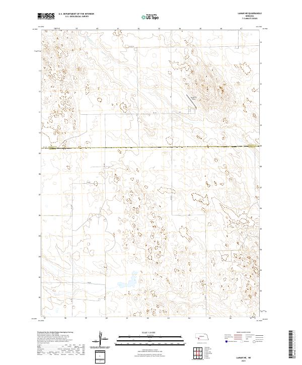
2021 Map of Lamar NE
USGS Topo · Published 2021About this map
The borderlands of the Nebraska Sandhills are defined by the Perkins Co Chase Co line, which divides the northern and southern halves of this high plains landscape. This era of land management is marked by a strict grid of section lines and gravel roads, including north-south corridors like 322 Ave and 324 Ave that navigate the undulating terrain. A private airstrip, Hendricks Field, sits in the northeast quadrant, serving as a vital link for local agricultural operations. Surface water is scarce in this semi-arid region, though the seasonal drainage of Spring Cr cuts through the northern sections. The map reveals the systematic organization of the Public Land Survey System, with township boundaries like t9n r40w and t8n r39w providing the framework for the ranching and farming operations that characterize this part of western Nebraska.
Find a feature on this map
19 named features on this map. Tap any name to fly to it.
Don’t see what you’re looking for? This feature index may not catch every label — zoom into the map to look around manually.
Map Details
Editions of this 2021 Lamar NE Map
This is the sole edition of this map. No revisions or reprints were ever made.
Other maps of this area

1954 · McCook
USGS Topo · 1:250,000

1957 · McCook
USGS Topo · 1:250,000

1958 · McCook
USGS Topo · 1:250,000

1961 · Lamar NE
USGS Topo · 1:24,000

1961 · Lamar
USGS Topo · 1:24,000

1961 · Brandon SE
USGS Topo · 1:24,000

1961 · Lamar NW
USGS Topo · 1:24,000

1961 · Brandon
USGS Topo · 1:24,000
1973 · Lamar
USGS Topo · 1:24,000
1973 · Chase
USGS Topo · 1:24,000