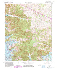
1967 Map of Lamasco
USGS Topo · Published 1983About this map
The Lake Barkley reservoir dominates the western landscape of this 1967 revision, reflecting a decade of transformation following the damming of the Cumberland River. The flooding created a deeply indented shoreline, where new developments like Blue Water Estates and Rockcastle Shores emerged alongside established crossroads like Rockcastle and Lamasco. This topographic study, photorevised in the early 1980s, documents the transition from a river-valley agricultural economy to one centered on recreation and conservation, evidenced by the Lake Barkley Waterfowl Refuge and various boat ramps.
Find a feature on this map
45 named features on this map. Tap any name to fly to it.
Don’t see what you’re looking for? This feature index may not catch every label — zoom into the map to look around manually.
Map Details
Editions of this 1967 Lamasco Map
2 editions found
Other maps of this area

1908 · Princeton
USGS Topo · 1:62,500

1910 · Princeton
USGS Topo · 1:62,500

1928 · Eddyville
USGS Topo · 1:48,000

1931 · Eddyville
USGS Topo · 1:62,500

1936 · Eddyville
USGS Topo · 1:48,000

1936 · Mont
USGS Topo · 1:24,000

1936 · Fenton
USGS Topo · 1:24,000

1936 · Golden Pond
USGS Topo · 1:48,000

1949 · Paducah
USGS Topo · 1:250,000

1950 · Paducah
USGS Topo · 1:250,000