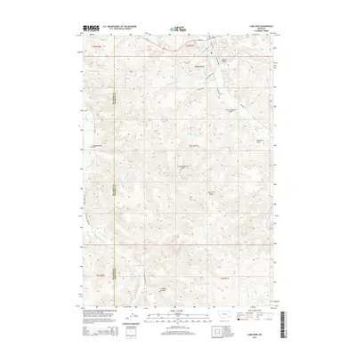
2014 Map of Lame Deer
USGS Topo · Published 2014About this map
Lame Deer serves as the primary hub in this portion of the Northern Cheyenne Indian Reservation, where Us-212 intersects with local thoroughfares like Cheyenne Ave and Westside Rd. The settlement is defined by its administrative and community center, including a local Po. Beyond the town site, the landscape is deeply etched by a network of seasonal and perennial drainage systems, including Spotted Elk Cr and Coal Cr, which flow through named landforms like Soldier Gulch and Sweet Medicine Gulch. Local history and family ties are anchored at the Muddy Creek Cem located to the west along Muddy Creek Rd. The geography reflects a quiet rural expanse where traditional Cheyenne place names, such as Calls First Gulch, mark the rugged coulees and creek forks that define the Rosebud and Big Horn county borderlands.
Find a feature on this map
38 named features on this map. Tap any name to fly to it.
Don’t see what you’re looking for? This feature index may not catch every label — zoom into the map to look around manually.
Map Details
Editions of this 2014 Lame Deer Map
This is the sole edition of this map. No revisions or reprints were ever made.
Other maps of this area

1954 · Hardin
USGS Topo · 1:250,000

1957 · Hardin
USGS Topo · 1:250,000

1958 · Hardin
USGS Topo · 1:250,000

1958 · Painted Hill
USGS Topo · 1:24,000

1958 · Bull Creek Lookout
USGS Topo · 1:24,000

1958 · Jimtown
USGS Topo · 1:24,000

1958 · Black Spring
USGS Topo · 1:24,000

1958 · Fisher Butte
USGS Topo · 1:24,000

1958 · Lame Deer
USGS Topo · 1:24,000

1958 · Badger Peak
USGS Topo · 1:24,000