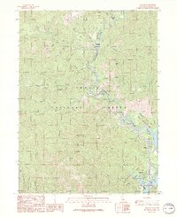
1990 Map of Lamoine
USGS Topo · Published 1990About this map
Sacramento River canyons dominate this northern California landscape, which is marked by the winding water and a string of mountain settlements established along the transportation corridor. In the final decade of the 20th century, towns like Lamoine, Delta, and Vollmers are shown positioned at the base of steep slopes where tributaries such as Dog Creek and Slate Creek meet the river. The southern portion of the survey highlights the northern reaches of Shasta Lake, where recreation facilities like Antlers Campground and Lakeshore East Campground emerged to serve the post-dam landscape. Higher elevations are characterized by landmarks like the Sugarloaf Lookout Radio Facility and the complex terrain of Mosquito Ridge. This map captures a specific phase of regional development within the Shasta National Forest, documenting the interplay between historical river-side communities and the modern lake-focused infrastructure of the Whiskeytown-Shasta-Trinity National Recreation Area.
Find a feature on this map
47 named features on this map. Tap any name to fly to it.
Don’t see what you’re looking for? This feature index may not catch every label — zoom into the map to look around manually.
Map Details
Editions of this 1990 Lamoine Map
2 editions found
Other maps of this area

1886 · Shasta
USGS Topo · 1:250,000

1890 · Red Bluff
USGS Topo · 1:250,000

1894 · Red Bluff
USGS Topo · 1:250,000

1894 · Shasta
USGS Topo · 1:250,000

1901 · Redding
USGS Topo · 1:125,000

1913 · Weaverville
USGS Topo · 1:125,000

1923 · Sawyers Bar
USGS Topo · 1:125,000

1931 · Etna
USGS Topo · 1:96,000

1934 · Etna
USGS Topo · 1:125,000

1935 · Dunsmuir
USGS Topo · 1:125,000