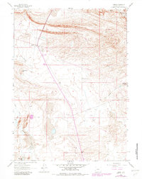
1961 Map of Lamont
USGS Topo · Published 1982About this map
Lamont serves as the central hub of this Carbon County landscape, situated where the high desert terrain meets early energy infrastructure. In the early 1960s, the map documents a distinct concentration of resource extraction, with numerous Oil Wells, a Gas Well, and several Prospects scattered across the sagebrush. Water remains a critical element for local ranching and industry, marked by the presence of Ferris Mtn Ranch and significant seasonal water bodies like Lost Soldier Lake and Mahoney Lake.
Find a feature on this map
19 named features on this map. Tap any name to fly to it.
Don’t see what you’re looking for? This feature index may not catch every label — zoom into the map to look around manually.
Map Details
Editions of this 1961 Lamont Map
2 editions found
Other maps of this area

1955 · Casper
USGS Topo · 1:250,000

1958 · Casper
USGS Topo · 1:250,000

1960 · Separation Rim
USGS Topo · 1:24,000

1960 · Bull Springs
USGS Topo · 1:24,000

1960 · Boggy Meadows
USGS Topo · 1:24,000

1961 · Lamont NE
USGS Topo · 1:24,000

1961 · Lamont
USGS Topo · 1:24,000

1961 · Bairoil
USGS Topo · 1:24,000

1962 · Casper
USGS Topo · 1:250,000

1962 · Whiskey Peak
USGS Topo · 1:24,000