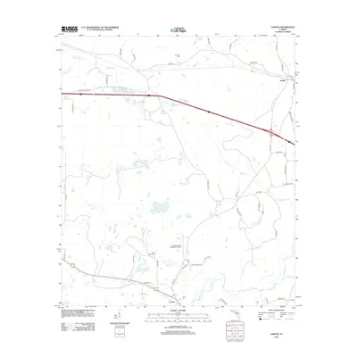
2012 Map of Lamont
USGS Topo · Published 2012About this map
The Aucilla River serves as a natural boundary in this North Florida landscape, defining a region where timberlands and agriculture meet. In the early 21st century, the settlement of Lamont remains a focal point in the southern portion of the map, situated near the intersection of Barber Hl and the historic Depot site. To the north, the small community of Aucilla is positioned along the northern reaches of the river, surrounded by a network of family-named roads such as Walt Bishop Rd and Mays Rd.
Find a feature on this map
52 named features on this map. Tap any name to fly to it.
Don’t see what you’re looking for? This feature index may not catch every label — zoom into the map to look around manually.
Map Details
Editions of this 2012 Lamont Map
This is the sole edition of this map. No revisions or reprints were ever made.
Other maps of this area

1954 · Greenville
USGS Topo · 1:24,000

1954 · Valdosta
USGS Topo · 1:250,000

1955 · Lamont
USGS Topo · 1:24,000

1955 · Waukeenah
USGS Topo · 1:24,000

1955 · Shady Grove
USGS Topo · 1:24,000

1955 · Lamont SE
USGS Topo · 1:24,000

1955 · Wacissa
USGS Topo · 1:24,000

1958 · Valdosta
USGS Topo · 1:250,000

1959 · Valdosta
USGS Topo · 1:250,000

1962 · Ashville
USGS Topo · 1:24,000