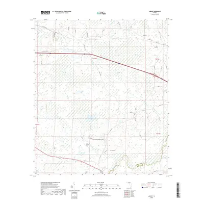
2018 Map of Lamont
USGS Topo · Published 2018About this map
Aucilla and Lamont anchor this portion of the Florida Panhandle along the Jefferson and Madison County line. The landscape is defined by the winding course of the Aucilla River and a network of small tributaries including Buggs Creek and Dixie Branch. Evidence of local heritage is found in family-named landmarks and resting places such as Scruggs Cem and Mount Marille Cem. The area maintains a rural character dominated by timber and agricultural lands, with features like Turkey Scratch Plantation Airport and Bishop Farms highlighting the local economy. Transport is facilitated by corridors such as the Drifton-Aucilla road and several family-named routes like Walt Bishop Rd and JR Tindell Rd. Near Lamont, the map identifies a Depot, signaling the town's historical connection to regional rail lines that once traversed this wooded terrain.
Find a feature on this map
53 named features on this map. Tap any name to fly to it.
Don’t see what you’re looking for? This feature index may not catch every label — zoom into the map to look around manually.
Map Details
Editions of this 2018 Lamont Map
This is the sole edition of this map. No revisions or reprints were ever made.
Other maps of this area

1954 · Greenville
USGS Topo · 1:24,000

1954 · Valdosta
USGS Topo · 1:250,000

1955 · Lamont
USGS Topo · 1:24,000

1955 · Waukeenah
USGS Topo · 1:24,000

1955 · Shady Grove
USGS Topo · 1:24,000

1955 · Lamont SE
USGS Topo · 1:24,000

1955 · Wacissa
USGS Topo · 1:24,000

1958 · Valdosta
USGS Topo · 1:250,000

1959 · Valdosta
USGS Topo · 1:250,000

1962 · Ashville
USGS Topo · 1:24,000