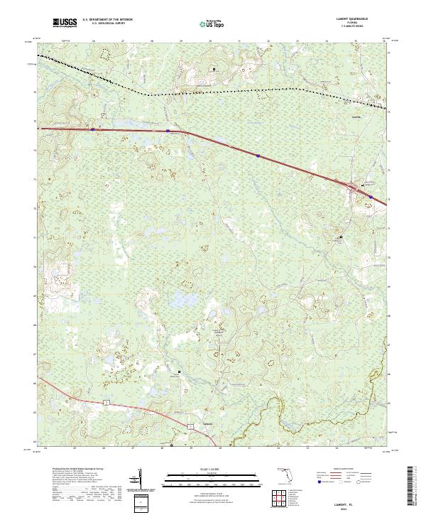
2024 Map of Lamont
USGS Topo · Published 2024About this map
The Aucilla River serves as the prominent natural boundary between Jefferson and Madison counties in this North Florida landscape. The small settlements of Aucilla and Lamont anchor the region, connected by a network of rural roads such as the Drifton-Aucilla route and Turkey Scratch Rd. For those researching local families, several burial grounds are preserved across the area, including the Aucilla Churchyard Cem and the Captain James S Walker Cem. The terrain is characterized by numerous watercourses like Wolf Creek and Buggs Creek, which drain into the expansive Gress Swamp. Large land holdings and agricultural operations are evident through features like the Turkey Scratch Plantation Airport, Manana Ranch, and Bishop Farms. The map also highlights Barber Hill, one of the few named topographic elevations in this wetland-rich corridor.
Find a feature on this map
56 named features on this map. Tap any name to fly to it.
Don’t see what you’re looking for? This feature index may not catch every label — zoom into the map to look around manually.
Map Details
Editions of this 2024 Lamont Map
This is the sole edition of this map. No revisions or reprints were ever made.
Other maps of this area

1954 · Greenville
USGS Topo · 1:24,000

1954 · Valdosta
USGS Topo · 1:250,000

1955 · Lamont
USGS Topo · 1:24,000

1955 · Waukeenah
USGS Topo · 1:24,000

1955 · Shady Grove
USGS Topo · 1:24,000

1955 · Lamont SE
USGS Topo · 1:24,000

1955 · Wacissa
USGS Topo · 1:24,000

1958 · Valdosta
USGS Topo · 1:250,000

1959 · Valdosta
USGS Topo · 1:250,000

1962 · Ashville
USGS Topo · 1:24,000