
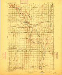
1895 Map of Lamoure
USGS Topo · Published 1895About this map
The James River meanders south through the heart of the eastern Dakotas in the late nineteenth century, serving as the primary axis for early settlement and transport. In this era of rapid expansion, the landscape is defined by the intersection of water and rail, with the Northern Pacific RR and the Chicago and Northwestern Ry carving paths through newly established townships. The map documents the layout of budding agricultural hubs like Lamoure, Oakes, and Grand Rapids, which sits along the upper reaches of the river. Numerous small settlements and post offices, such as Yorktown, Port Emma, and Berlin, appear as vital points in a fledgling network. The terrain is organized into distinct territorial blocks like Black Loam and Grandview, reflecting the surveyor's focus on the region's agricultural potential and natural hydrology, including Cottonwood Creek and the Maple River.
Find a feature on this map
65 named features on this map. Tap any name to fly to it.
Don’t see what you’re looking for? This feature index may not catch every label — zoom into the map to look around manually.
Map Details
Editions of this 1895 Lamoure Map
2 editions found
Other maps of this area

1894 · Monango
USGS Topo · 1:62,500

1894 · La Moure
USGS Topo · 1:62,500

1894 · Ellendale
USGS Topo · 1:62,500

1894 · Hecla
USGS Topo · 1:62,500

1894 · Savo
USGS Topo · 1:62,500

1894 · Fullerton
USGS Topo · 1:62,500

1894 · Oakes
USGS Topo · 1:62,500

1896 · Columbia
USGS Topo · 1:125,000

1896 · Jamestown
USGS Topo · 1:125,000

1896 · Edgeley
USGS Topo · 1:125,000