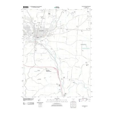
2010 Map of Lancaster
USGS Topo · Published 2010About this map
Lancaster anchors this landscape where the Hocking River meets several prominent geological rises, including Waterworks Hill and the distinct landmark of Mount Pleasant. The map records a dense collection of historical burial grounds that speak to the long-standing community structure of Fairfield County, ranging from the large Forest Rose Cemetery and Elmwood Cemetery in the city to the smaller Amish Cemetery and Gideon Cemetery in the outlying areas.
Find a feature on this map
97 named features on this map. Tap any name to fly to it.
Don’t see what you’re looking for? This feature index may not catch every label — zoom into the map to look around manually.
Map Details
Editions of this 2010 Lancaster Map
This is the sole edition of this map. No revisions or reprints were ever made.
Other maps of this area

1907 · Logan
USGS Topo · 1:62,500

1907 · Lancaster
USGS Topo · 1:62,500

1907 · Thurston
USGS Topo · 1:62,500

1909 · Thornville
USGS Topo · 1:62,500

1909 · Lancaster
USGS Topo · 1:62,500

1909 · Logan
USGS Topo · 1:62,500

1909 · Thurston
USGS Topo · 1:62,500

1947 · Columbus
USGS Topo · 1:250,000

1958 · Carroll
USGS Topo · 1:24,000
1958 · Amanda
USGS Topo · 1:24,000