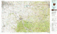
1984 Map of Lancaster
USGS Topo · Published 1985About this map
The Hocking River valley and the southeastern sprawl of Columbus define this mid-1980s landscape, illustrating a period of significant suburban expansion and industrial transition. To the east, the map reveals the complex terrain of the Wayne National Forest and the Perry County Reclamation Area, highlighting the intersection of natural preservation and historical resource extraction. Major transportation corridors including I-70 and Us 33 link established city centers like Lancaster and Zanesville with growing communities such as Reynoldsburg and Gahanna.
Find a feature on this map
182 named features on this map. Tap any name to fly to it.
Don’t see what you’re looking for? This feature index may not catch every label — zoom into the map to look around manually.
Map Details
Editions of this 1984 Lancaster Map
This is the sole edition of this map. No revisions or reprints were ever made.
Other maps of this area

1901 · Dublin
USGS Topo · 1:62,500

1902 · Westerville
USGS Topo · 1:62,500

1903 · Dublin
USGS Topo · 1:62,500

1903 · Athens
USGS Topo · 1:62,500

1904 · Westerville
USGS Topo · 1:62,500

1904 · Zaleski
USGS Topo · 1:62,500

1904 · Chesterhill
USGS Topo · 1:62,500

1905 · Athens
USGS Topo · 1:62,500

1906 · Chesterhill
USGS Topo · 1:62,500

1906 · Chillicothe
USGS Topo · 1:62,500