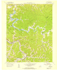
1954 Map of Lancer
USGS Topo · Published 1955About this map
The Levisa Fork and Johns Creek define the rugged topography of this eastern Kentucky region in the early 1950s. The landscape is marked by the sprawling waters of Dewey Reservoir, which transformed the local geography following the construction of the Dewey Dam. Along the shorelines, recreation is evident at the Sandy Valley Girl Scout Camp and Shawnee Boy Scout Camp, while the Brandy Keg Lookout Tower watches over the heavily wooded ridges.
Find a feature on this map
86 named features on this map. Tap any name to fly to it.
Don’t see what you’re looking for? This feature index may not catch every label — zoom into the map to look around manually.
Map Details
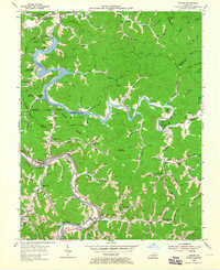
Editions of this 1954 Lancer Map
2 editions found
Other maps of this area

1886 · Prestonsburg
USGS Topo · 1:125,000

1892 · Prestonsburg
USGS Topo · 1:125,000

1914 · Laynesville
USGS Topo · 1:48,000

1914 · Inez
USGS Topo · 1:48,000

1915 · Paintsville
USGS Topo · 1:48,000

1915 · Prestonsburg
USGS Topo · 1:62,500

1916 · Harold
USGS Topo · 1:62,500

1916 · Inez
USGS Topo · 1:62,500

1917 · Paintsville
USGS Topo · 1:62,500

1918 · Prestonsburg
USGS Topo · 1:62,500