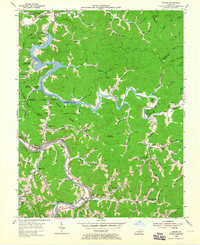
1954 Map of Lancer
USGS Topo · Published 1965About this map
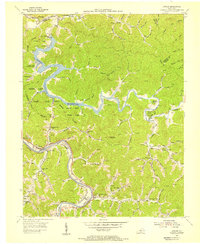
Dewey Reservoir dominates the center of this Floyd County landscape, formed by the construction of Dewey Dam and reshaping the valleys of Johns Creek and its many branches. In the mid-1950s, the surrounding area was undergoing significant development as Jenny Wiley State Park took shape, with recreation spots like the Brandy Keg Boat Dock appearing alongside older landmarks like the Brandy Keg Lookout Tower. To the southwest, the Levisa Fork remains a vital transport corridor, carrying both the Chesapeake and Ohio railroad and primary roads through Lancer and the edge of Prestonsburg. Numerous small schools and churches, including Lower Cow Creek Sch and Philadelphia Ch, are scattered throughout the winding hollows, reflecting a dispersed rural population that relied on the intricate network of creek-bottom roads and local coal-and-gas industry sites.
Find a feature on this map
84 named features on this map. Tap any name to fly to it.
Don’t see what you’re looking for? This feature index may not catch every label — zoom into the map to look around manually.
Map Details
Editions of this 1954 Lancer Map
2 editions found
Other maps of this area

1886 · Prestonsburg
USGS Topo · 1:125,000

1892 · Prestonsburg
USGS Topo · 1:125,000

1914 · Laynesville
USGS Topo · 1:48,000

1914 · Inez
USGS Topo · 1:48,000

1915 · Paintsville
USGS Topo · 1:48,000

1915 · Prestonsburg
USGS Topo · 1:62,500

1916 · Harold
USGS Topo · 1:62,500

1916 · Inez
USGS Topo · 1:62,500

1917 · Paintsville
USGS Topo · 1:62,500

1918 · Prestonsburg
USGS Topo · 1:62,500