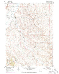
1952 Map of Lander SE
USGS Topo · Published 1986About this map
The Popo Agie River carves through the northwestern corner of this Fremont County landscape, supporting early agricultural development through the Wise Ditch and Millard Ditch systems. The terrain transitions from the river valley to the prominent heights of Blue Ridge and Monument Butte, revealing a history of industrial activity along the high ground. Evidence of the region's extraction economy is visible through the Williams Mine, an unnamed Coal Mine, and a Gravel Pit. An Old Railroad Grade indicates a former transportation corridor that once served these upland mining operations. Significant landmarks such as Hall Ranch and several named drainages, including Government Draw and Ballenger Draw, provide essential orientation points for those tracing the development of land use and water rights in this part of Wyoming.
Find a feature on this map
23 named features on this map. Tap any name to fly to it.
Don’t see what you’re looking for? This feature index may not catch every label — zoom into the map to look around manually.
Map Details
Editions of this 1952 Lander SE Map
5 editions found
Other maps of this area

1952 · Hudson
USGS Topo · 1:24,000

1952 · Lander SE
USGS Topo · 1:24,000

1952 · Lander
USGS Topo · 1:24,000

1952 · Lander NW
USGS Topo · 1:24,000

1953 · Ninemile Hill
USGS Topo · 1:24,000

1953 · Arapahoe
USGS Topo · 1:24,000

1953 · Del Monte Ridge
USGS Topo · 1:24,000

1953 · Weiser Pass
USGS Topo · 1:24,000

1954 · Wolf Point
USGS Topo · 1:24,000

1955 · Lander
USGS Topo · 1:250,000