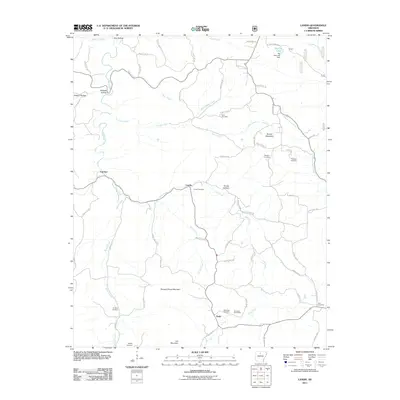
2011 Map of Landis
USGS Topo · Published 2011About this map
Landis and the surrounding Ozark landscape are defined by a complex network of winding waterways and secluded hollows. The settlement pattern is largely dictated by the terrain, with small communities like Thola and Fairview connected by an intricate web of county roads that follow the ridges and creek beds. A significant number of family and community burial grounds, such as Treat Cemetery, Freeman Cemetery, and Passmore Cemetery, are scattered across the quadrangle, serving as vital landmarks for genealogists. The presence of the Economy Post Office near the southern edge of the map highlights the enduring local infrastructure in this rural area. Water features are central to the geography, from the broad Bear Creek and Long Creek to the Big Flat Lake Dam in the northeast. Notable elevations including Buzzard Roost Mountain and Round Mountain provide a vertical contrast to the deep incisions of Elm Hollow and Wildcat Hollow.
Find a feature on this map
68 named features on this map. Tap any name to fly to it.
Don’t see what you’re looking for? This feature index may not catch every label — zoom into the map to look around manually.
Map Details
Editions of this 2011 Landis Map
This is the sole edition of this map. No revisions or reprints were ever made.
Other maps of this area

1890 · Mountain Home
USGS Topo · 1:125,000

1891 · Mountain Home
USGS Topo · 1:125,000

1892 · Marshall
USGS Topo · 1:125,000

1892 · Mountain View
USGS Topo · 1:125,000

1893 · Yellville
USGS Topo · 1:125,000

1894 · Mountain View
USGS Topo · 1:125,000

1894 · Mountain Home
USGS Topo · 1:125,000

1894 · Marshall
USGS Topo · 1:125,000

1901 · Marshall
USGS Topo · 1:125,000

1903 · Yellville
USGS Topo · 1:125,000