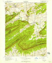
1952 Map of Landisburg
USGS Topo · Published 1958About this map
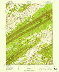
The borough of Landisburg and the village of Loysville anchor this mid-century survey of the ridge-and-valley landscape in Perry and Cumberland counties. The terrain is defined by the sharp parallel lines of Blue Mountain, Pisgah Ridge, and Germany Ridge, which funnel the waters of Sherman Creek through the heart of the quadrangle. A significant local institution, the Trestler Orphan Home, is situated just outside Loysville, while the Hidden Valley Boy Scout Camp occupies a bend in the creek further south.
Find a feature on this map
68 named features on this map. Tap any name to fly to it.
Don’t see what you’re looking for? This feature index may not catch every label — zoom into the map to look around manually.
Map Details
Editions of this 1952 Landisburg Map
4 editions found
Other maps of this area

1904 · Carlisle
USGS Topo · 1:62,500

1907 · New Bloomfield
USGS Topo · 1:62,500

1919 · Newville
USGS Topo · 1:62,500

1930 · Loysville
USGS Topo · 1:62,500

1933 · Loysville
USGS Topo · 1:62,500

1943 · New Bloomfield
USGS Topo · 1:62,500

1943 · Carlisle
USGS Topo · 1:62,500

1945 · Newville
USGS Topo · 1:62,500

1950 · Harrisburg
USGS Topo · 1:250,000
1952 · Spruce Hill
USGS Topo · 1:24,000
Featured Places
- Saville Township, PA
- Landisburg, PA
- Loysville, Tyrone Township
- Bridgeport, Spring Township
- Northeast Madison Township, PA