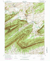
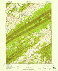
1952 Map of Landisburg
USGS Topo · Published 1984About this map
Loysville and Landisburg anchor this rural landscape in the mid-1950s, a period when small-town institutional life was centered around the Tressler Orphan Home and local civic landmarks like the Hidden Valley Boy Scout Camp. The terrain is defined by the heavy ridgelines of Blue Mountain and North Mountain, which create deep valleys such as Tyrone Valley and Sheaffer Valley. These geographic barriers directed early transit and settlement patterns, visible in the winding course of Sherman Creek and the remnants of an Old Railroad Grade.
Find a feature on this map
49 named features on this map. Tap any name to fly to it.
Don’t see what you’re looking for? This feature index may not catch every label — zoom into the map to look around manually.
Map Details
Editions of this 1952 Landisburg Map
4 editions found
Other maps of this area

1904 · Carlisle
USGS Topo · 1:62,500

1907 · New Bloomfield
USGS Topo · 1:62,500

1919 · Newville
USGS Topo · 1:62,500

1930 · Loysville
USGS Topo · 1:62,500

1933 · Loysville
USGS Topo · 1:62,500

1943 · New Bloomfield
USGS Topo · 1:62,500

1943 · Carlisle
USGS Topo · 1:62,500

1945 · Newville
USGS Topo · 1:62,500

1950 · Harrisburg
USGS Topo · 1:250,000
1952 · Spruce Hill
USGS Topo · 1:24,000
Featured Places
- Saville Township, PA
- Landisburg, PA
- Loysville, Tyrone Township
- Bridgeport, Spring Township
- Northeast Madison Township, PA