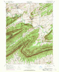
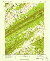
1952 Map of Landisburg
USGS Topo · Published 1970About this map
Loysville and Landisburg anchor this 1950s study of central Pennsylvania, where the landscape is defined by the steep, parallel ridges of Blue Mountain. The map details a rural society organized around small crossroads like Alinda and Milltown, with a significant institutional presence at the Tressler Orphan Home in the north. The winding path of Sherman Creek cuts through Sheaffer Valley, providing a natural corridor for movement between the heights of Mt Dempsey and Germany Ridge.
Find a feature on this map
58 named features on this map. Tap any name to fly to it.
Don’t see what you’re looking for? This feature index may not catch every label — zoom into the map to look around manually.
Map Details
Editions of this 1952 Landisburg Map
4 editions found
Other maps of this area

1904 · Carlisle
USGS Topo · 1:62,500

1907 · New Bloomfield
USGS Topo · 1:62,500

1919 · Newville
USGS Topo · 1:62,500

1930 · Loysville
USGS Topo · 1:62,500

1933 · Loysville
USGS Topo · 1:62,500

1943 · New Bloomfield
USGS Topo · 1:62,500

1943 · Carlisle
USGS Topo · 1:62,500

1945 · Newville
USGS Topo · 1:62,500

1950 · Harrisburg
USGS Topo · 1:250,000
1952 · Spruce Hill
USGS Topo · 1:24,000
Featured Places
- Saville Township, PA
- Landisburg, PA
- Loysville, Tyrone Township
- Bridgeport, Spring Township
- Northeast Madison Township, PA