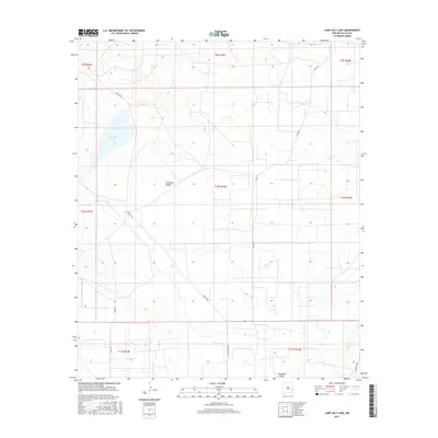
2017 Map of Lane Salt Lake
USGS Topo · Published 2017About this map
Lane Salt Lake dominates the northwestern portion of this New Mexico landscape, serving as a primary hydrological focal point in an otherwise arid expanse of Lea County. The terrain transitions into the Simanola Valley, which stretches across the central and southern sections of the map. This area is defined by a sparse but essential network of ranching roads and local tracks, including the Mcguffin Rd and the prominent Nine Ranch corridor. Small-scale water management is evident at Red Tank, a necessary feature for sustaining life and livestock in the high desert. The survey captures the organized grid of the Public Land Survey System, illustrating how township and range boundaries like t10s r33e structured the settlement and land use of the Llano Estacado region in the early 21st century.
Find a feature on this map
19 named features on this map. Tap any name to fly to it.
Don’t see what you’re looking for? This feature index may not catch every label — zoom into the map to look around manually.
Map Details
Editions of this 2017 Lane Salt Lake Map
This is the sole edition of this map. No revisions or reprints were ever made.
Other maps of this area

1954 · Brownfield
USGS Topo · 1:250,000

1958 · Brownfield
USGS Topo · 1:250,000

1961 · Johnson Ranch
USGS Topo · 1:24,000

1962 · Brownfield
USGS Topo · 1:250,000

1970 · Johnson Ranch
USGS Topo · 1:24,000

1970 · Simanola Valley
USGS Topo · 1:24,000

1972 · Milnesand SW
USGS Topo · 1:24,000

1973 · Soldier Hill
USGS Topo · 1:24,000

1973 · Caprock
USGS Topo · 1:24,000
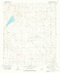
1973 · Lane Salt Lake
USGS Topo · 1:24,000