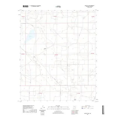
2020 Map of Lane Salt Lake
USGS Topo · Published 2020About this map
Lane Salt Lake and the wide expanse of the Simanola Valley characterize this high plains landscape of Lea County. The area is defined by a sparse but deliberate network of ranching roads and water management features essential for livestock in this arid environment. Significant thoroughfares like McGuffin Rd and Nine Ranch connect remote outposts, while named water sources such as Red Tank provide critical reference points for land navigation. The map illustrates the traditional township and range grid system, highlighting the intersection of large-scale ranching operations with the natural topography of the llano. This modern survey reflects the enduring character of New Mexico's ranching country, where legacy names like T155 Nine Ranch and T161 Four Lakes continue to mark the geography of the southeastern corner of the state.
Find a feature on this map
17 named features on this map. Tap any name to fly to it.
Don’t see what you’re looking for? This feature index may not catch every label — zoom into the map to look around manually.
Map Details
Editions of this 2020 Lane Salt Lake Map
This is the sole edition of this map. No revisions or reprints were ever made.
Other maps of this area

1954 · Brownfield
USGS Topo · 1:250,000

1958 · Brownfield
USGS Topo · 1:250,000

1961 · Johnson Ranch
USGS Topo · 1:24,000

1962 · Brownfield
USGS Topo · 1:250,000

1970 · Johnson Ranch
USGS Topo · 1:24,000

1970 · Simanola Valley
USGS Topo · 1:24,000

1972 · Milnesand SW
USGS Topo · 1:24,000

1973 · Soldier Hill
USGS Topo · 1:24,000

1973 · Caprock
USGS Topo · 1:24,000
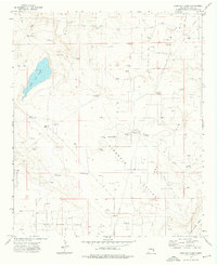
1973 · Lane Salt Lake
USGS Topo · 1:24,000