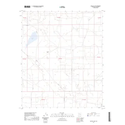
2023 Map of Lane Salt Lake
USGS Topo · Published 2023About this map
Lane Salt Lake dominates the northwest corner of this West Texas borderlands terrain, situated in the northeastern reaches of Lea County. The landscape is defined by the broad Simanola Valley, a corridor characterized by livestock ranching infrastructure and a network of named tracks and county roads. Numerous ranch-related features are documented, including the Red Tank and the expansive Nine Ranch properties. Transportation through this arid region relies on routes such as Mcguffin Rd, Burro Aly, and T155 Nine Ranch, reflecting the area's rural development and agricultural heritage. The map provides a precise look at the township and range divisions of the Public Land Survey System, illustrating how this portion of the Llano Estacado was partitioned into sections.
Find a feature on this map
19 named features on this map. Tap any name to fly to it.
Don’t see what you’re looking for? This feature index may not catch every label — zoom into the map to look around manually.
Map Details
Editions of this 2023 Lane Salt Lake Map
This is the sole edition of this map. No revisions or reprints were ever made.
Other maps of this area

1954 · Brownfield
USGS Topo · 1:250,000

1958 · Brownfield
USGS Topo · 1:250,000

1961 · Johnson Ranch
USGS Topo · 1:24,000

1962 · Brownfield
USGS Topo · 1:250,000

1970 · Johnson Ranch
USGS Topo · 1:24,000

1970 · Simanola Valley
USGS Topo · 1:24,000

1972 · Milnesand SW
USGS Topo · 1:24,000

1973 · Soldier Hill
USGS Topo · 1:24,000

1973 · Caprock
USGS Topo · 1:24,000
1973 · Lane Salt Lake
USGS Topo · 1:24,000