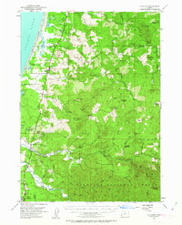
1954 Map of Langlois
USGS Topo · Published 1963About this map
The coastal dairy and ranching settlements of Langlois and Denmark dominate the western edge of this mid-century survey along the Oregon coast. The landscape is defined by the unique hydrology of the New River, which runs parallel to the Pacific Ocean shoreline, creating a series of freshwater bodies like New Lake and Floras Lake. Agriculture is a primary driver of the local economy here, evidenced by the presence of Cranberry Bogs near the coast and established operations like the Taylor Ranch further inland.
Find a feature on this map
67 named features on this map. Tap any name to fly to it.
Don’t see what you’re looking for? This feature index may not catch every label — zoom into the map to look around manually.
Map Details
Editions of this 1954 Langlois Map
3 editions found

Other maps of this area

1896 · Coos Bay
USGS Topo · 1:125,000

1898 · Coos Bay
USGS Topo · 1:125,000

1899 · Port Orford
USGS Topo · 1:125,000

1900 · Coos Bay
USGS Topo · 1:125,000

1903 · Port Orford
USGS Topo · 1:125,000

1942 · Coquille
USGS Topo · 1:62,500

1943 · Bandon
USGS Topo · 1:62,500

1944 · Bandon
USGS Topo · 1:62,500

1945 · Coquille
USGS Topo · 1:62,500

1954 · Coos Bay
USGS Topo · 1:250,000