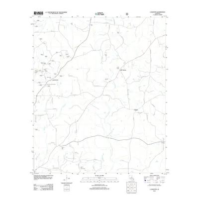
2012 Map of Langston
USGS Topo · Published 2012About this map
Germantown and the surrounding piney woods of Webster Parish reveal a landscape shaped by early settlement and industrial extraction. This 2012 survey documents the persistent rural character of the area, anchored by family cemeteries such as Carter Cem, Martin Cem, and Miller Cem. The settlement at Holly Springs sits near the winding course of Black Lake Bayou, while the Germantown Lookout Tower stands as a landmark of regional forestry management. To the south, the Minden Oil and Gas Field indicates the importance of energy resources to the local economy. The map traces a dense network of country roads, including Bicycle Rd and Dogwood Trl, which connect small communities like Langston to the broader geography of north Louisiana.
Find a feature on this map
54 named features on this map. Tap any name to fly to it.
Don’t see what you’re looking for? This feature index may not catch every label — zoom into the map to look around manually.
Map Details
Editions of this 2012 Langston Map
This is the sole edition of this map. No revisions or reprints were ever made.
Other maps of this area

1922 · Sarepta
USGS Topo · 1:62,500

1924 · Sarepta
USGS Topo · 1:62,500

1947 · Minden
USGS Topo · 1:62,500

1949 · Minden
USGS Topo · 1:62,500

1949 · Gibsland
USGS Topo · 1:62,500

1950 · Gibsland
USGS Topo · 1:62,500

1952 · Homer
USGS Topo · 1:62,500

1955 · Shreveport
USGS Topo · 1:250,000

1956 · Shreveport
USGS Topo · 1:250,000

1956 · Sarepta
USGS Topo · 1:62,500