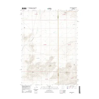
2015 Map of Lankin Dome
USGS Topo · Published 2015About this map
The Granite Mountains dominate the southern portion of this landscape, rising above the surrounding high plains of central Wyoming. This topographical study highlights a network of prominent peaks and geological formations, including the distinctive Lankin Dome, McIntosh Peak, and the high point of Moonstone. These outcrops are separated by significant depressions and valleys like Lankin Gap, Nolen Pocket, and Miller Pocket, which channel the drainage of Lankin Cr. In the northwest, the terrain levels out into the Agate Flats, a stark contrast to the rocky elevations to the south. Historically significant transport routes cross the territory, most notably the Waltman Sweetwater Freight Rd and the Beaver Rim Rd, which trace the natural contours of the land across the Fremont and Natrona County line.
Find a feature on this map
22 named features on this map. Tap any name to fly to it.
Don’t see what you’re looking for? This feature index may not catch every label — zoom into the map to look around manually.
Map Details
Editions of this 2015 Lankin Dome Map
This is the sole edition of this map. No revisions or reprints were ever made.
Other maps of this area

1951 · Bucklin Reservoirs
USGS Topo · 1:24,000

1951 · Lone Mountain
USGS Topo · 1:24,000

1951 · Black Rock Gap
USGS Topo · 1:24,000

1951 · Split Rock
USGS Topo · 1:24,000

1951 · Split Rock NW
USGS Topo · 1:24,000

1951 · Lankin Dome
USGS Topo · 1:24,000

1952 · Coyote Springs
USGS Topo · 1:24,000

1952 · Mc Intosh Meadows
USGS Topo · 1:24,000

1955 · Casper
USGS Topo · 1:250,000

1958 · Casper
USGS Topo · 1:250,000