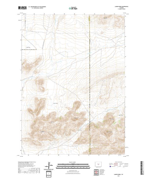
2021 Map of Lankin Dome
USGS Topo · Published 2021About this map
The Granite Mountains dominate this high-desert landscape in central Wyoming, where dramatic topography rises sharply from the basin floor. The terrain is defined by prominent peaks and ridges including Bills Peak, Mcintosh Peak, and the namesake Lankin Dome. This area represents a rugged corridor where the Fremont and Natrona County line cuts north-to-south through a network of drainages such as Sage Hen Creek and Lankin Creek. Historically significant transport routes like the Waltman Sweetwater Freight Rd and Agate Flat Rd underscore the region's importance for transit and freighting across the state's interior. Unusual geological and place-name features like Nolen Pocket, Moonstone, and West Sage Hen Rocks point to a landscape shaped by both wind-scoured erosion and the early naming traditions of local ranchers and travelers.
Find a feature on this map
23 named features on this map. Tap any name to fly to it.
Don’t see what you’re looking for? This feature index may not catch every label — zoom into the map to look around manually.
Map Details
Editions of this 2021 Lankin Dome Map
This is the sole edition of this map. No revisions or reprints were ever made.
Other maps of this area

1951 · Bucklin Reservoirs
USGS Topo · 1:24,000

1951 · Lone Mountain
USGS Topo · 1:24,000

1951 · Black Rock Gap
USGS Topo · 1:24,000

1951 · Split Rock
USGS Topo · 1:24,000

1951 · Split Rock NW
USGS Topo · 1:24,000

1951 · Lankin Dome
USGS Topo · 1:24,000

1952 · Coyote Springs
USGS Topo · 1:24,000

1952 · Mc Intosh Meadows
USGS Topo · 1:24,000

1955 · Casper
USGS Topo · 1:250,000

1958 · Casper
USGS Topo · 1:250,000