
1980 Map of Lark
USGS Topo · Published 1980About this map
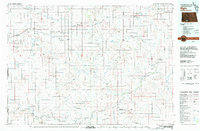
The Burlington Northern railroad corridor defines the development pattern around Lark in this 1980 survey of Grant County. The small settlement is situated where the rail line intersects several drainage systems, most notably Louse Creek and Otter Creek. The landscape is characterized by its creek beds and distinctive terrain features like Rattlesnake Buttee Creek and Gap Creek, which break up the open plains. Cultural landmarks of particular interest to genealogists and local historians include the Pleasant View Cem, located southeast of the main cluster of buildings at Lark. The presence of a Substa and several scattered Well sites reflects the rural infrastructure of the era, while the topographic contours reveal the subtle draws and rises that shaped agricultural land use in this part of North Dakota.
Find a feature on this map
10 named features on this map. Tap any name to fly to it.
Don’t see what you’re looking for? This feature index may not catch every label — zoom into the map to look around manually.
Map Details
Editions of this 1980 Lark Map
This is the sole edition of this map. No revisions or reprints were ever made.
Other maps of this area

1954 · Bismarck
USGS Topo · 1:250,000

1958 · Bismarck
USGS Topo · 1:250,000

1972 · Carson SE
USGS Topo · 1:24,000

1980 · Otter Creek West
USGS Topo · 1:24,000

1980 · Brisbane
USGS Topo · 1:24,000

1980 · Otter Creek East
USGS Topo · 1:24,000

1980 · Crown Butte Creek SE
USGS Topo · 1:24,000

1980 · Dogtooth Buttes
USGS Topo · 1:24,000

1980 · Raleigh
USGS Topo · 1:24,000
1980 · Elgin
USGS Topo · 1:100,000