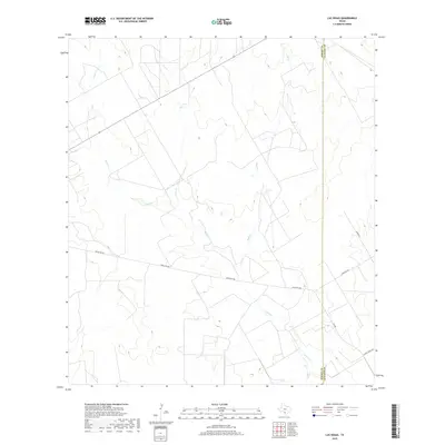
2019 Map of Las Vegas
USGS Topo · Published 2019About this map
The south Texas plains of Dimmit County and LaSalle County meet in this topographic landscape, dominated by the drainage networks of Espio Cr and Elm Cr. The terrain is defined by its rural ranching character, where few roads penetrate the wide ranchlands. Ranch Rd 468 serves as the primary east-west artery across the central portion of the map, intersecting with the Dimmit Co and LaSalle Co boundary line. Local ranching life is grounded by landmarks like the Johnson Rch, situated near the eastern edge. In the southeast corner, the network of small creeks like Skull Cr converges, showing the subtle elevation changes that guide seasonal water flow through this arid environment. The map captures a moment of modern land use where large-scale ranching properties continue to define the geography of the Rio Grande Plain.
Find a feature on this map
9 named features on this map. Tap any name to fly to it.
Don’t see what you’re looking for? This feature index may not catch every label — zoom into the map to look around manually.
Map Details
Editions of this 2019 Las Vegas Map
This is the sole edition of this map. No revisions or reprints were ever made.
Other maps of this area

1925 · San Roque Lake 1-a
USGS Topo · 1:48,000

1927 · Bart
USGS Topo · 1:62,500

1929 · Cotulla
USGS Topo · 1:125,000

1932 · Valley Wells
USGS Topo · 1:62,500

1939 · Big Wells
USGS Topo · 1:62,500

1940 · Catarina
USGS Topo · 1:62,500

1940 · Artesia Wells
USGS Topo · 1:62,500

1953 · Crystal City
USGS Topo · 1:250,000

1955 · Crystal City
USGS Topo · 1:250,000

1956 · Woodward
USGS Topo · 1:62,500